William Shedd
Popular version of paper 5aPA1
Presented Friday morning, May 27, 2011
161st ASA Meeting, Seattle, Was.

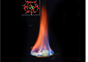
Natural gas hydrates are a solid ice-like form of natural gas (some call them the “ice that burns”, as in the photo above) found in the deep water marine margins of continents and under permafrost in Arctic regions worldwide. The natural gas combines with water molecules under high pressure and low temperature. They have been found on the seafloor as large mounds at natural seep sites (see photo below) and in the subsurface through the drilling of scientific research wells. They are recognized as a very significant potential energy source in the future and are estimated to be the single largest store of carbon on the planet (more than all plants, animals, fossil fuels, and carbon gases combined), and, thus, probably play a large role in regulating atmospheric carbon.

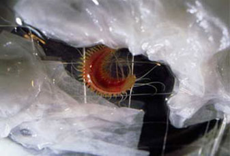
Note the tube worms surrounding and on the hydrate mound in the photo above and the worm in the photo below – they are “chemosynthetic” organisms, that convert the natural gas from the hydrate back to carbohydrate for nourishment.

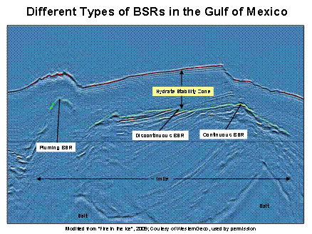
Hydrate saturated sediments are acoustically faster and slightly less dense than water saturated sediments, but much faster and denser than gas saturated sediments. These properties allow for the identification of hydrate saturated sediments that overlie gas saturated sediments. Since temperatures increase with depth within the earth, hydrates become unstable at some point and “melt” back to gaseous natural gas, allowing for geophysical identification. The resulting geophysical reflector, traditionally referred to as a “bottom simulating reflector”, or BSR, represents the base of hydrate stability and often mimics the seafloor in areas where subsurface heat flow is laterally consistent. In areas where plumes of warm, salty, gas-rich fluids rise close to the seafloor, often near the flanks of salt bodies that are common in the Gulf of Mexico, the hydrate stability zone thins dramatically and appears as a “plume” on seismic data; where the base of gas hydrate stability (“BGHS”) crosses through area of alternating sands and shales, “discontinuous” BSRs occur; and, where the BGHS coincides with the sedimentary bedding or where very fine-grained, muddy sediments predominate, “continuous” BSRs are observed (see the figure below).

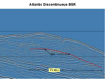
BSRs off the U.S. Atlantic coast are typically much larger than in the Gulf of Mexico, with dimensions in the dozens to hundreds of miles (see figure below) and very high potential gas resources are likely.

The Bureau of Ocean Energy Management, Regulation, and Enforcement has used 3-D seismic data in the Gulf of Mexico and 2-D seismic data in the Atlantic: 1) to map the distribution of BSRs to understand the geological controls on hydrate distribution, 2) to assess the future gas resource potential of hydrates, and 3) to drill 7 wells in the GOM to test these ideas, 6 of which had moderate to high hydrate saturations in sand reservoirs. Go to the public website, boemre.gov, for more information.