151st ASA Meeting, Providence, RI
[ Lay Language Paper Index | Press Room ]
When Katrina Hit California
Peter
Gerstoft - gerstoft@ucsd.edu
Marine Physical Laboratory
University of California, San Diego
Mike Fehler
Los Alamos National Laboratory
Karim Sabra
University of California, San Diego
Popular version of paper 2aAO6
Presented Tuesday morning, June 6, 2006
151st ASA Meeting, Providence, RI
Scientific
version of paper is available here
From half a continent away, we made an unusual seismic observation of a
killer hurricane on Aug. 29, 2005 as Katrina bore down on New Orleans
and the Gulf Coast. By using an array of 150 seismic stations in
Southern California and a signal processing technique called
beamforming to identify the seismic signal, we recorded a signal
strength 1,000 times greater than that generated by volcanic tremor.
The energy of waves in the deep ocean is
usually attenuated well before it reaches bottom. But in the shallow
waters of the Mississippi River delta, Katrina’s waves interacted
directly with the seafloor. Though the exact mechanisms behind the
transfer of energy from ocean waves to seismic waves is not well
understood, it appears that the same breaking and shoaling waves that
dramatically changed the look of the Mississippi and Louisiana
coastlines were strong enough to generate P, or primary waves, through
the Earth, in a clear pattern. We observed the P waves that propagated
at depths of 1,100 km (700 miles) even before the hurricane made
landfall.
Because those body waves travel at between 3,000 and 12,000 meters per
second, we could see them reach California about 10 minutes after they
struck. We were able to see them using beamforming, a standard approach
for comparing and averaging out signals across an array of seismic
stations. Beamforming enabled us to locate the origin of the P waves
and surface waves being generated by Katrina.
The findings demonstrate that ocean microseisms can be detected at
great distances. They also open the possibility of further use of
seismic noise for studying the Earth and Earth processes, even at very
low signal level. Though hurricane researchers employ a number of tools
— from satellites to aircraft to buoys — to model and track hurricanes,
seismic instruments could stand to improve our physical understanding
of them, especially of the dynamics of the often violent ocean waves
they generate.
|
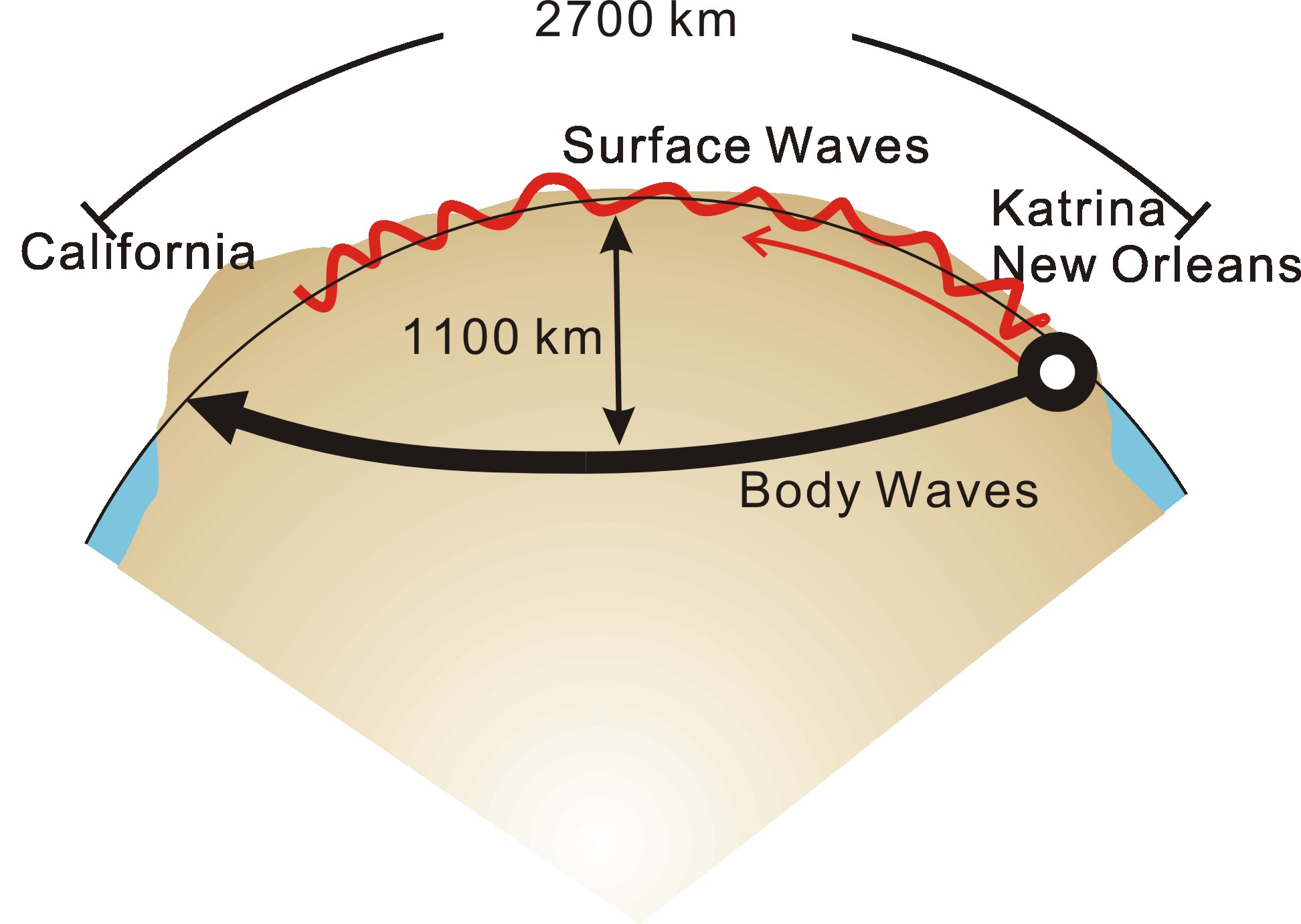
Figure 1: Schematic of travel paths of observed surface
and body waves.
|
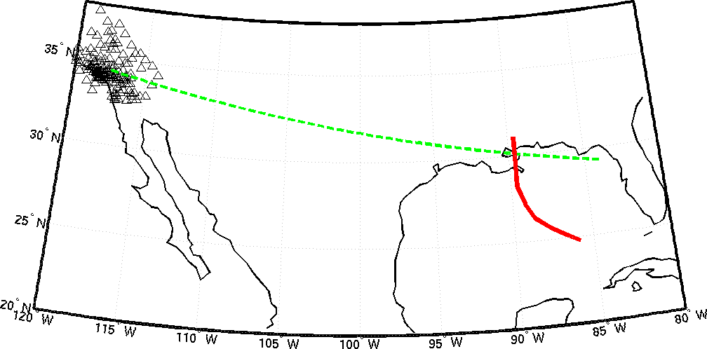
Figure 2: Path from hurricane Katrina to the seismic
array in California (triangles). Track of Katrina is shown in red.
|
[ Lay Language Paper Index | Press Room ]
|